Date Posted : October 7, 2025
in : News and Events
All Roads has completed the first fully autonomous highway paving project in North America, using Topcon’s 3D MC-Max Paving Technology on a 10-kilometer section of the Trans-Canada Highway, approximately 50 kilometers east of Vancouver, British Columbia.
Self-Driving Paver Successfully Completes Highway Paving


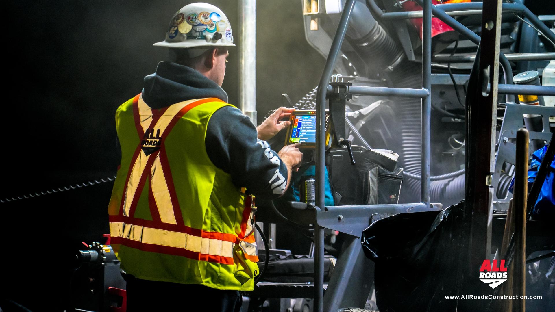
We are proud to be the first contractor in North America to implement a virtual ski on a paver, delivering superior surface precision and paving consistency. We are also the first in Canada to utilize Auto Steer and the RDMC Absolute Solution. This advanced system scans the existing road surface in real time and seamlessly overlays the engineered design of the final grade, providing the machine with precise control over elevation and thickness to meet design specifications with exceptional accuracy.
Topcon's 3D MC-Max is a cloud-based machine control platform that integrates GNSS (Global Navigation Satellite System) receivers, high-precision sensors, and real-time data processing. By combining Local Positioning Systems (LPS) with GPS technology, the system automates screed height, width, and steering adjustments. This results in accurate paving directly aligned to 2D and 3D design files, improving ride quality, extending pavement life, and optimizing both productivity and material usage.
The system's "virtual ski" function uses an original ground (OG) surface scan from Topcon's RDM1 scanner. The scan is imported directly into the Vogele Paver base station, providing precise reference for automated screed control.
"For LPS configuration, switching between left and right sides of the paver can be done from the machine's screen interface," explains Denis Labelle, All Roads' VP of Operations. "This eliminates the manual cable adjustments required by older systems. The software averages paving thickness dynamically based on its location on the scanned surface, delivering a smooth finish without the logistical challenges of assembling or disassembling a physical boom."
In practice, surface scanning is often faster than setting up the physical booms used in conventional paving workflows. Compared to earlier systems, 3D MC-Max also reduces hardware requirements by using OEM Vogele trackers. Only a control box and two GNSS receivers are required—no external cables—streamlining setup and reducing downtime. The system's autosteer function further supports accuracy by automatically aligning the paver horizontally, maintaining a consistent edge profile.
Labelle notes that RDMC, when used with localized control files, allows paving to local elevation standards without requiring MM+ or robotic total station setups. The workflow involves:
- Scanning the surface with the RDM1,
- Fusing the scan with a leveled, localized control point file,
- Importing both the scanned and design surfaces into the machine.
This approach enables paving in local coordinates with sub-centimeter accuracy, requiring only a single GNSS base station positioned on a leveled control point.
Blair Coan, All Roads' GPS & Survey Technician, highlights the efficiency gains: "Traditional robotic total stations typically need to be repositioned every 120 meters. In contrast, the RDMC system with localized control requires only one GNSS base station, which is only moved if the machine exceeds radio range. This reduces setup time and interruptions significantly."
The successful implementation of the 3D MC-Max system on the Trans-Canada Highway demonstrates the practical benefits of autonomous paving technologies. With streamlined setup, increased precision, and reduced reliance on traditional total station workflows, these advancements represent a significant step forward in modern paving practices.
What's with all these acronyms?
- RDM-1 - Road Design Measurement, Version 1
- RDMC - Road Design Machine Control
- MM+ - Millimeter GPS with accuracy within millimeters
- MCR-3 - Machine Control Receiver, Version 3
- MC Max - Machine Control Max (Newest version of the MCR-3)